Thanks to the help of several people who have posted links to this site on local Facebook groups and websites in the last few weeks, my blog has recently begun to attract a lot more traffic. This is obviously great news, and I've taken it as a sign of encouragement that I should try to make this page even easier to find. To this end, I've bought a more professional domain name, www.malvernrailway.co.uk, and will be watermarking my new pictures as such from now on. For those regular visitors who may have the original address saved in their bookmarks, fear not: the old address, http://malvernrailway.blogspot.com will still work just like normal. Anyway, this isn't much more than a paintjob to help the site to get higher up the rankings (I hope!) for anyone searching on Google. Thanks to all who have supported the project by donating photographs or by letting me onto their land recently, and thanks also to the several thousand visitors I've had since the start of this year. There's plenty more still to do, and I look forward to getting my walking boots on and taking more photographs over the coming spring and summer.
Martin
Saturday, 9 April 2016

Peachfield Road
Heading south from Tewkesbury Junction and across Malvern Common you soon reach Peachfield Road, which crosses the surviving GWR bridge next to the site of the abandoned Malvern Wells (GWR) station. During the time of the Midland/LMS Ashchurch branch, Peachfield Road actually featured two consecutive railway bridges, although little trace remains of this today.
Starting at Tewkesbury Junction, this shot from Jim Clemens shows how busy the site was in its heyday. The Midland Railway bridge is just visible in the distance on the far right, although by the time this picture was taken the Malvern end of the Ashchurch branch had been closed for eight years.
Perhaps the best shot of what the old bridge used to look like comes from this postcard taken from near the corner of St Andrew's Road. The only postcard company I have managed to find by the name of Walker is that of John Walker & Co., who operated in London from 1903-10. The car coming down the bridge has no number plate that I can see, which means that this picture must have been taken before 1904.

The picture below shows the view from the Peachfield Road LMS bridge, looking north towards Great Malvern. Note the aqueduct which channeled water across the Common. A matching shot is difficult because the cutting was later filled in, but have tried to show how the gardens of the houses on the right taper in line with where the railway once lay.


Dropping down on the north side of where the bridge was, it is possible to see some remnants of where the old Midland cutting was in the gardens of those homeowners who opted to buy the filled-in cutting to extend their property.
The only photograph I have been able to find of live railway activity south of Peachfield's LMS Bridge is this shot, taken in around 1950, showing a demolition train hauling broken sleepers back into Tewkesbury Junction:


The eastern side of the old line is more open and provides an opportunity to see the old railway embankment more fully.


The eastern side of the embankment also features a few more fenceposts which have slowly been reclaimed by the undergrowth. Careful when walking here: there are lots of loose pieces of wire lying around which can be a tripping hazard.


The path can get very muddy in winter but in the drier months it makes a very pleasant walk down to Worcestershire Golf Course.
The Bridge
Starting at Tewkesbury Junction, this shot from Jim Clemens shows how busy the site was in its heyday. The Midland Railway bridge is just visible in the distance on the far right, although by the time this picture was taken the Malvern end of the Ashchurch branch had been closed for eight years.
 |
| 'Tewkesbury Junction Malvern Wells, approx 1960.' |

 |
| The same location in 2016. Note how the land has been raised following the filling in of the cutting. |
 |
| The view of the old bridge from the south side, April 1956. Note the buffer which was used after the Malvern section closed in 1952. |
 |
| The reverse view of the bridge in April 1956, from the north side. |


The same view in 2016.
 |
| 'View from Peachfield Rd Bridge to Great Malvern Station, 14/4/62'. This shot shows a slightly more angled view. |
 |
| These gardens interrupt the old line until you get to the old Tewkesbury Junction site. |
 |
| The view north from the western side of the LMS cutting. |
 |
| A similar shot from further up the same fence. |
 |
| The reverse view, showing a one-carriage LMS train (possibly #58364) as it exits the bridge on its way to Great Malvern. |
 |
| 4908 'Broome Hall' passes the defunct Midland Railway bridge, 1955. |
South of the Bridge
Heading south from Peachfield Road, you immediately walk into a clearing which contains several railway relics. The clearing is only short, probably no more than fifty metres, but is marked by a low embankment flanked by old railway fence posts.
The only photograph I have been able to find of live railway activity south of Peachfield's LMS Bridge is this shot, taken in around 1950, showing a demolition train hauling broken sleepers back into Tewkesbury Junction:
 |
| 'Demolition train, from Peachfield Road bridge, c. 1950' |
With the Midland Railway bridge long demolished and the railway cutting partly infilled, it is quite difficult to recognise the path of the old Ashchurch branch today. Nevertheless, starting below Peachfield Road, the following three pictures show the approximate location of the bridge from the south side:


Turning around, the old railway treeline becomes apparent and the line leads down onto what is now a public footpath. On the right is a small housing estate which sits under where the old GWR station stands.

The path itself sits on a slight embankment, and looking down on the western side reveals some old concrete fenceposts which are still tangled up with loops of wire.


The eastern side of the old line is more open and provides an opportunity to see the old railway embankment more fully.


The eastern side of the embankment also features a few more fenceposts which have slowly been reclaimed by the undergrowth. Careful when walking here: there are lots of loose pieces of wire lying around which can be a tripping hazard.


The path can get very muddy in winter but in the drier months it makes a very pleasant walk down to Worcestershire Golf Course.
 |
| The view north to where the bridge was. |
 |
| The length of the clearing. From this point south, the line is a narrow public footpath. |
Friday, 1 April 2016
A Post About Posts
This week's post takes us away from railways briefly to investigate something I found while looking for a panoramic view of the Ashchurch-Malvern line. Dotted around West Malvern and Malvern Wells are several old iron posts which I think were once used as gas vents for sewers running under the hills (but I am happy to be corrected on this!). I found four in West Malvern and two above Malvern Wells, and know of one more near Holywell Road which I have yet to find. If anyone knows the whereabouts of the full set and their exact purpose, please get in touch!
The four West Malvern vents can be found at these locations:
The West Malvern posts are very tall and thin, and each features a decorative crown adorned with four compass points on top. I was lucky enough to take these pictures on an unbelievably sunny day in early February, but only had my 5 megapixel mobile phone camera to hand, so could not zoom in on the more distant posts.
The next two posts are of a different style and sit on the eastern slope of the hills. Featuring a small brazier on top, these posts are shorter and more remote than their counterparts in West Malvern.
These posts sit above the Wells, so first we have to walk through the Wyche Cutting and back into the homeland...
West Malvern
The four West Malvern vents can be found at these locations:
 |
| Post #1 sits on Westminster Bank, where the sky is this blue, all the time. |
 |
| Post #1 from slightly further back. |
 |
| Post #2 sits behind a house on West Malvern Road and can best be seen from the hill path above. |
 |
| The view east from the plateau between North Hill and Worcestershire Beacon. |
 |
| A distant glimpse of Post #3 which sits on the southern slope of Sugarloaf Hill. |
 |
| The final post we found,which sits next to the junction of West Malvern Rd and Brockhill Rd. |
Malvern Wells
The next two posts are of a different style and sit on the eastern slope of the hills. Featuring a small brazier on top, these posts are shorter and more remote than their counterparts in West Malvern.
These posts sit above the Wells, so first we have to walk through the Wyche Cutting and back into the homeland...
 |
| The Wyche Cutting. The posts lie along the footpath running southwards from the cutting along the eastern face of Perseverance Hill. |
 |
| The first post sits next to a house right by the cutting. The Wyche Inn is visible behind. |
 |
| A closer look at the first post, and more azure sky! |
 |
| The view eastwards from the footpath. The tree line running away from the hill to the right of the large shed in the middle distance is the old Malvern-Ashchurch branch crossing the Shuttlefast Lane site. |
 |
| This dramatic picture shows the second post, which sits to the south of the first, about thirty feet above the footpath. |
 |
| The view directly down from Post #2. The horizontal tree line flanking the golf course is the Ashchurch-Malvern branch. |
 |
| The base of the second post. |
Friday, 25 March 2016
Brotheridge Green
Brotheridge Green is a half-mile stretch of the old Malvern-Ashchurch railway which runs parallel to Gilver's Lane near Hanley Castle. Today, the site is a nature reserve maintained by the Worcestershire Wildlife Trust and is open to all. The site retains some original features, notably a beautiful arched bridge, the remains of a lineside shed, and the stumps of a few telegraph poles.
Looking over the bridge, the cutting running across Brotheridge Common is still clear to see, and not much has changed. The picture below has kindly been donated by John Mudge, and shows the line still intact two years after it closed.
Wandering down the steps into the cutting, the area under the bridge has been fenced off to separate the private land to the east with the nature reserve to the west.
Taking a step back reveals the lovely old brickwork of the bridge more clearly, with a red arch contrasting with the blue roadside wall across the top.


Looking towards Malvern, the line follows a ruler-straight path towards the hills. This photo from Jim Clemens shows the line not too long after John Mudge's picture near the top of the page:




At its western end, the section becomes (deliberately) overgrown and has become a haven for badgers, with large holes pockmarking the embankment.

The Bridge
The bridge itself is little-used and connects Melrose Farm to two parallel roads nearby. The blue brick used is very similar to other bridges in the area, notably those at Upper Hook Rd and Warren Farm.
 |
| The bridge from the south side. |
 |
| The western side of the bridge. |
 |
| The bridge markings. |
 |
| 'Tewkesbury and Malvern Railway - Looking towards the Malverns from Brotheridge Common' 27th March, 1954. |
 |
| The same view in 2016. The pylons are still there, but obscured by mist in this shot. |
 |
| Sadly, the view to the east is not nearly so interesting! |
 |
| The eastern face of the bridge through the jungle. |
 |
| A look down into the eastern cutting, which is private land and not part of the reserve. |
 |
| The original sign from the bridge at Brotheridge Green, courtesy of Malvern Museum. |
The Cutting
Wandering down the steps into the cutting, the area under the bridge has been fenced off to separate the private land to the east with the nature reserve to the west.
 |
| The view towards Upton from the cutting floor. |


Looking towards Malvern, the line follows a ruler-straight path towards the hills. This photo from Jim Clemens shows the line not too long after John Mudge's picture near the top of the page:
 |
| The route to Malvern. |
 |
| An almost identical shot in 2016. |
 |
| 'Brotheridge Green Freight' |
 |
| 'Brotheridge Green Passenger' |
 |
| The reserve's information sign. |
 |
| These signs mark the beginning and the end of the reserve. |
The Shed
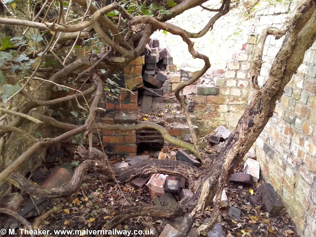
After the bridge itself (which is maintained as it is still in use), perhaps the most interesting relic at Brotheridge Green is this lineside shed, which is in the process of being swallowed by a hedge. Similar to the shed at Coton Cottage Farm, this building also used to contain a tiny hearth.


The Line
 |
| 'Bridge at Brotheridge Green, LMS, Looking West, April 1956.' |
 |
| The reverse view, looking east, 2016. |
 |
| Another view eastwards. |
 |
| The view westwards from further along the line. |
 |
| A view of the bridge from further down the line. |
 |
| About halfway down this section, the cutting turns into an embankment as we walk towards Malvern. |
Telegraph Posts
Once the cutting near the bridge turns into an embankment, some stumps of old telegraph posts become visible. I found four in total, each left with about a foot long.
 |
| Post No. 1. |
 |
| Each stump has an old cable anchor sitting next to it. |
 |
| Looking west, 3/4 of the way along the section. |


 |
| Another stump sits next to some steps marking where a public footpath crosses the reserve. |
 |
| 'Hobson Patent' |

 |
| Another look eastwards, with the reserve's birdwatching hide visible in the distance. |
 |
| Stump No. 3. |
 |
| Stump No. 4. |
 |
| Stump No. 5 in the undergrowth. |
The End of the Section
At its western end, the section becomes (deliberately) overgrown and has become a haven for badgers, with large holes pockmarking the embankment.

 |
| A pile of rubble at the back of The Lodge. |
 |
| The view southwards from the embankment. |
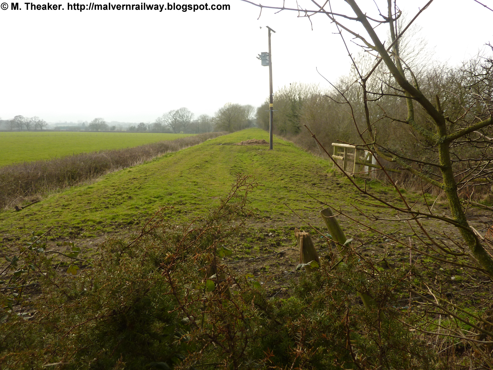 |
| End of the line: Brotheridge Green ends here, whereas the embankment carries on to the demolished bridge on Gilver's Lane. |
Subscribe to:
Posts (Atom)