Hello! I'm always looking out for more material: if you have anything you would like to share (especially relating to my Request List), please get in touch! Twitter: @malvernrailway.
Showing posts with label Upton. Show all posts

Saturday, 22 October 2016

Demolition Trains

Among the excellent pictures donated to this project by Jim Clemens are some shots of the demolition trains that were sent to remove the line after its closure. Some might consider these a little bleak, but I think that they provide a really interesting bridge between the line as a working piece of industry and the beginning of its reversion to nature. The line itself was dug up by a crane mounted to the back of a van, which lifted the sleepers and rails into empty trucks parked adjacent. John Clements, the farmer at Pigeon House Farm near Upton, remembers:
'I think I was about 10 or 11 when the line was taken up and I have memories of a wonderful old steam crane lifting the tracks. The operator let me up on board to pull a few leavers, which I guess would never be allowed in this day and age of health and safety and risk assessment. It was a wonderful machine to a young lad with unguarded cogs and pulleys and steam issuing forth from every seal and joint. After the tracks were removed they lifted the sleepers and took them away, I assume to be reused.'
The pictures below are mainly untitled but seem to have been taken around the area between Clive's Fruit Farm on Upper Hook Road and what is now Upton Rugby ground. I hope you enjoy them!

The steam-powered crane loads an empty truck.
This is one of my favourite pictures from this entire project, albeit maybe for artistic rather than historical reasons! Upton station is visible in the distance.
Down the line to Upton.
'Demolition Train M.R. Malvern to Ashchurch'. Taken from Upper Hook Road bridge - the permanent way hut has since been removed.
Another shot near Upton, taken approximately where the public footpath runs above the rugby pitches now.

Saturday, 6 August 2016

More Pictures from Upton-on-Severn

This week I have some more old pictures of Upton station to show you, including a rare shot of the railway bridge across Old St at the very end of its life. These pictures have now been added to the main page for Upton-on-Severn station, so head over there to see the full post. Enjoy!


Saturday, 11 June 2016

Upton Embankment

Upton Embankment is the name I am giving to the remaining section of raised railway line on the eastward approach into Upton-on-Severn. As this 1946 map shows, the line ran along a deep cutting under the bridge at Upper Hook Road and then up onto a modest embankment, before finally crossing Old Street by means of a brick bridge.


Today, the section of the embankment nearest the town has been levelled to provide pitches for Upton Rugby Club, but the section behind the sports ground remains intact. Accessed by a set of steps above a brick abutment, the embankment has been turned into a 400m long public footpath, and a few railway relics are still visible in the undergrowth. There is also a very impressive brick arched bridge which once allowed a footpath to run under the railway.


We begin this section of the walk at the top of the public footpath next to New Street at the southern end of Clive's Fruit Farm. This is the view towards Upton, with the railway embankment clearly visible on the right.
 

The public footpath down the railway embankment is on the left of this shot, but the top of the path off New Street also features another historical site of note, to the right of the Severn Trent sewage treatment works. This is the Cholera Burial Ground, where victims of the outbreak in Upton in 1832 are buried.
 

 The Railway Embankment


Turning back to the railway footpath, we head south-east towards Upton through a tree line in full bloom. I set the camera to a slightly lower light filter to compensate for the dappled shade and the result was a riot of green. These pictures show the walk into Upton and don't give much about the railway away, but they do show the footpath off as a very pretty walk. I might return in winter once the greenery has died back to see if this exposes the man-made landscape a bit more.


About 200m along the footpath we encounter our first railway relic; a dismembered telegraph pole. The stump marks the beginning of a short section in which several interesting pieces of railway infrastructure still survive.


The Bridge


By far the most impressive railway relic on this route is the brick bridge which allowed the public footpath across the field to cross under the railway. Walking down the line into Upton, the first clue of the bridge's existence comes with the shallow brick wall flanking the embankment, shown here on the left.


The southern side of the track also has a small wall, although this one has retained its rounded top. Looking over the edge shows the surprisingly large drop down onto the field below:


A milepost stands guard in the undergrowth just to the west of the bridge.


Dropping down to the ground on the northern side of the embankment, you can see that the bridge is of similar construction to the small bridge at Worcestershire Golf Course and the larger arch at Warren Farm. Large diagonal supporting walls hold the earthworks back and open the bridge up to the field alongside. Unfortunately, the area under the bridge was still about six inches deep in water when I took these pictures (a very warm dry spell in May!) and so I'm not sure if it's ever possible to cross through to the other side without bringing wellies. A project for the future.


This picture shows an old lump of wood sticking out of the ground. It may possibly be a fencepost reclaimed from an old railway sleeper; it certainly doesn't seem to be serving any real purpose now!


The End of the Line


Another mile post stands towards the end of the embankment.


At the end of the track, a brick abutment separates the old embankment from the rugby pitches below.

Saturday, 23 January 2016

Clive's Fruit Farm / Upper Hook Rd.

Coming round a gentle corner from Brotheridge Green and The Boynes, the Midland branch line ran through a deep cutting and under a road bridge at Upper Hook Road. Running on into a straight section of track, the railway had only one more corner to face as it completed the last few hundred yards of its route from Malvern to Upton-on-Severn.


Today, the bridge remains in use by road vehicles and is maintained accordingly (a comparative rarity on a route where many overbridges were destroyed after they fell into disuse). The railway cutting to the west is also still clearly visible, although the cutting to the east has been levelled to make way for several rows of polytunnels at Clive's Fruit Farm.


Photographs


Approaching from the west along Upper Hook Road, the road slopes gently downwards before hitting a small chicane as it crosses the bridge. The pictures below were taken on a cold January morning and the bare trees allow a fuller view of the architecture. The buildings on the other side belong to Clive's Fruit Farm, a popular local business which now presides over this section of the line.

Upper Hook Road bridge from the west.
The following pictures show the view from the northern side of the bridge of the old railway cutting. The top picture is from 9th May 1953, and shows the line running from Upton up towards the left curve at Brotheridge Green.


The embankment on the eastern side of the bridge has been more significantly altered, and the tall trees here make it difficult to see for any great distance.

The view to the south, where the embankment peters out into the flat land currently occupied by the fruit farm.

The bridge from the east.

The middle of the bridge with its markings.

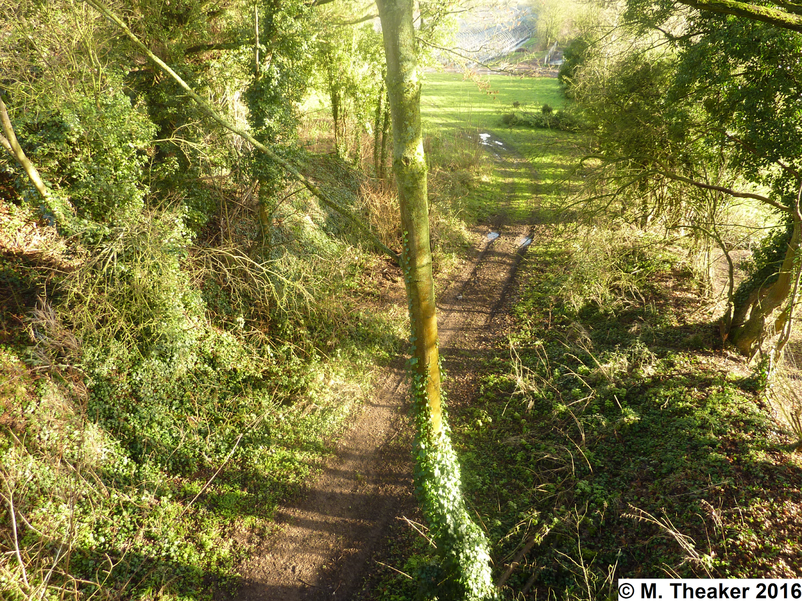
A view of the cutting north of the bridge, showing how steeply the embankment rises up.

Upper Hook Road bridge from the top of the north embankment.